Latest Posts
-
Guess Who’s Back
Well…it’s been a minute. When I finished visiting all 63 U.S. national parks in 2023, I wasn’t really sure what was next. Exploring that final park felt like the end of a chapter I’d been writing for a long time.… Continue reading
-
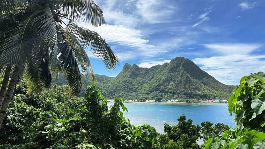
National Park of American Samoa
Wow. I can’t believe I’m sitting down to write about my final national park trip! This journey has been several years in the making. When I started, there were 59 national parks, and since then, 4 new ones have been… Continue reading
-
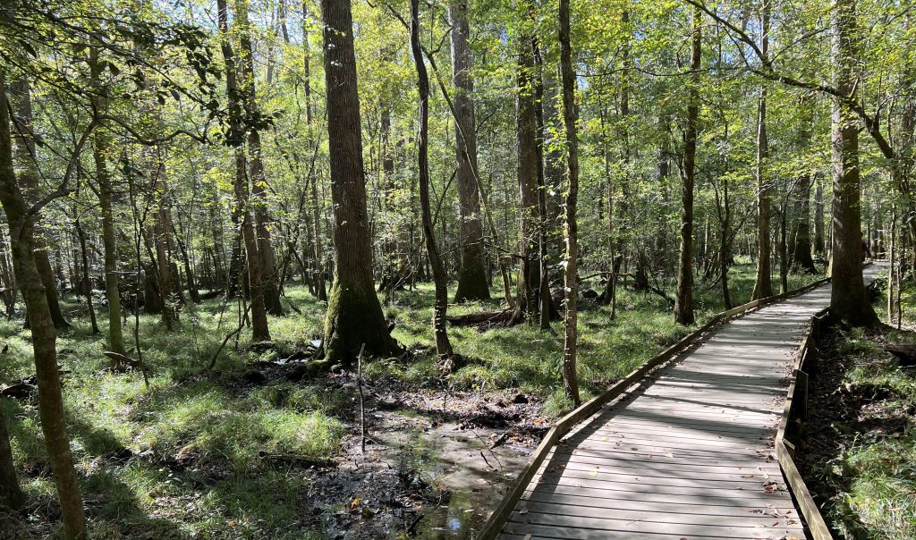
Congaree National Park
Congaree National Park is located in central South Carolina, and preserves the largest tract of old growth cypress left in the world. The forest populates a floodplain of the Congaree and Wateree Rivers. The park contains the tallest of 15… Continue reading
-
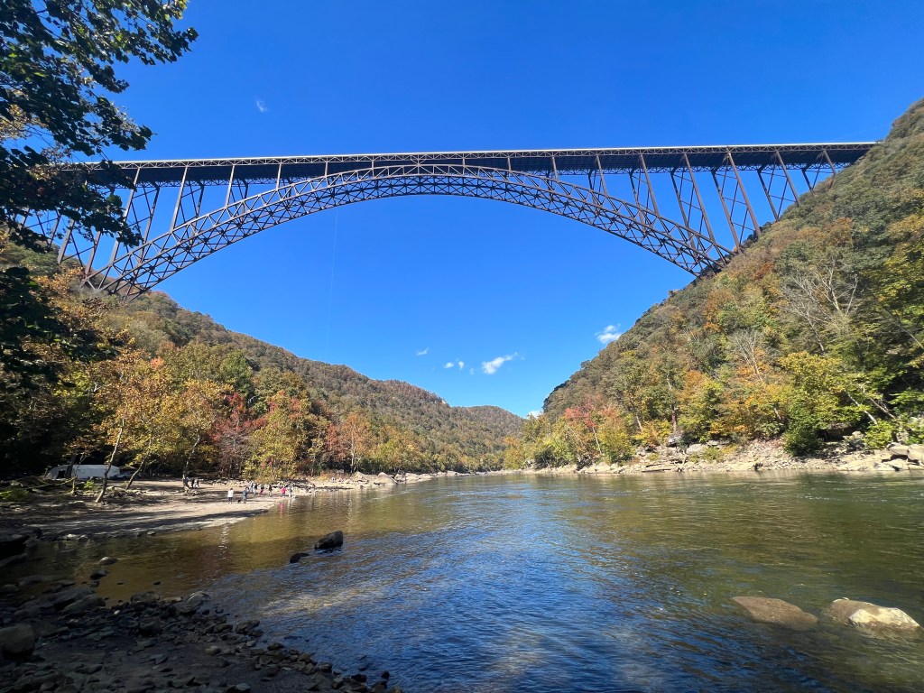
New River Gorge National Park
The morning of our fourth day, we ventured to West Virginia to visit America’s newest national park, New River Gorge. This national park protects and maintains the New River Gorge in southern West Virginia and the Appalachian Mountains. The whole… Continue reading
-
Cuyahoga Valley National Park
Cuyahoga Valley became a national park in October 2000. It’s currently the only national park that originated as a national recreation area. The park is a refuge for native plants and wildlife. The Cuyahoga River, meaning crooked river, gives way… Continue reading

-
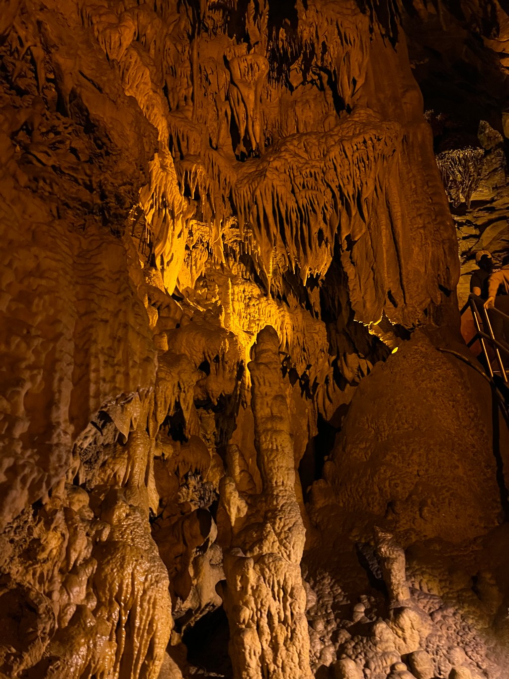
Mammoth Cave National Park
Mammoth Cave National Park preserves the longest known cave system- the most extensive in the world. No known cave in the world is even half as long. There is evidence that humans explored Mammoth Cave 4,000 years ago, but it… Continue reading
-
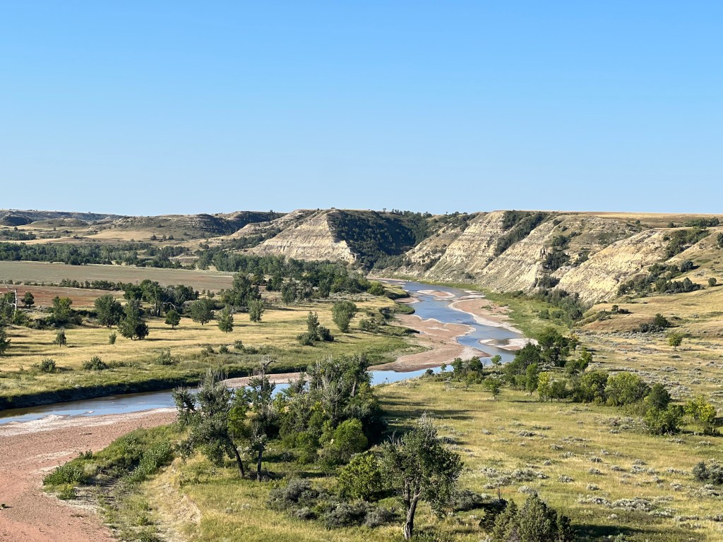
Theodore Roosevelt National Park
Theodore Roosevelt National Park encompasses the badlands of western North Dakota. This park honors Theodore Roosevelt and his presidency, which was marked by a legacy of conservation in our public lands. The park has two main units, North and South. … Continue reading
-
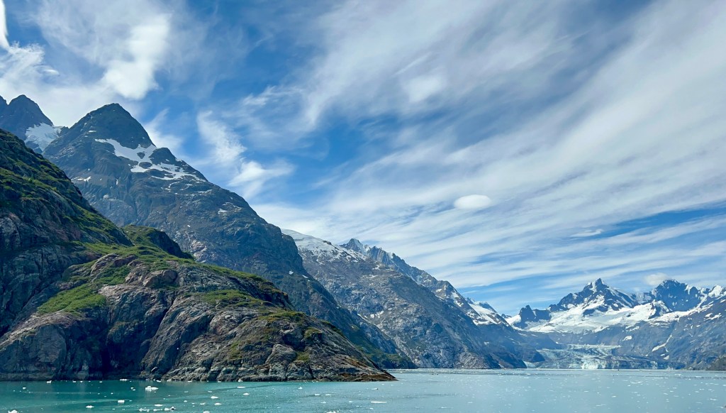
Glacier Bay National Park
Glacier Bay National Park encompasses 3.3 million acres of prestigious land and water. The waters in Glacier Bay are some of the richest on earth, and because of this, it’s one of the largest protected preserves in the world. It’s… Continue reading
-
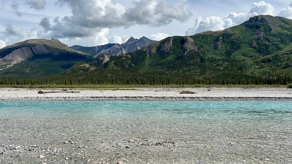
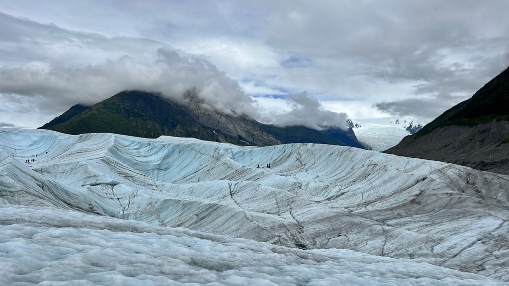
Wrangell St. Elias National Park
Wrangell St. Elias (WSE) is the largest national park in the United States. The park covers 13.2 million acres, and is home to 12 of the 20 tallest mountains in North America. It is 6 times the size of Yellowstone! … Continue reading
-
Gates of the Arctic & Kobuk Valley
Welcome to the three-part series of Alaska’s National Parks, 2nd edition. This summer I explored four more of Alaska’s eight National Parks: Gates of the Arctic, Kobuk Valley, Wrangell St. Elias, and Glacier Bay. This was a much-anticipated trip, with… Continue reading